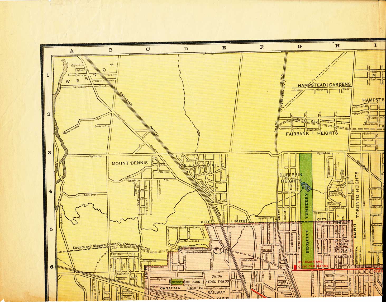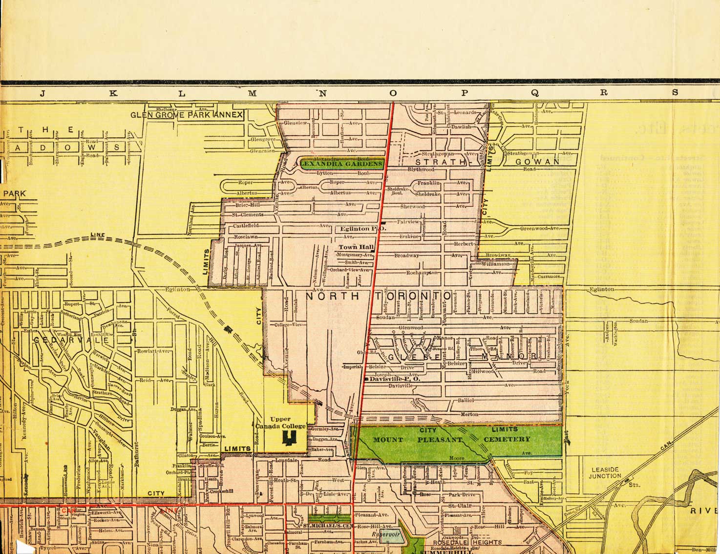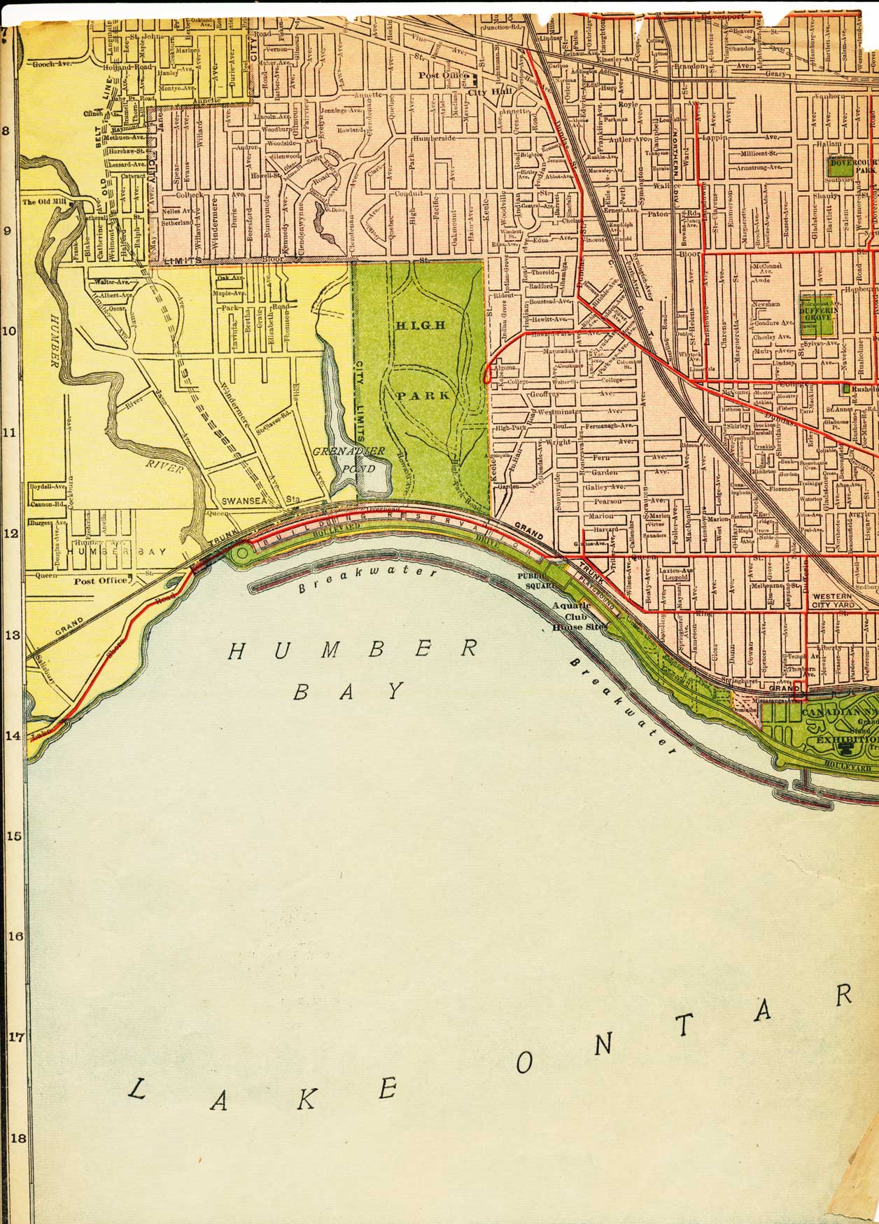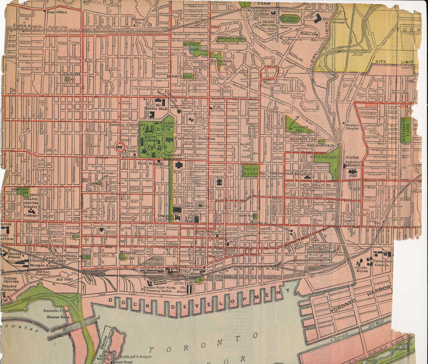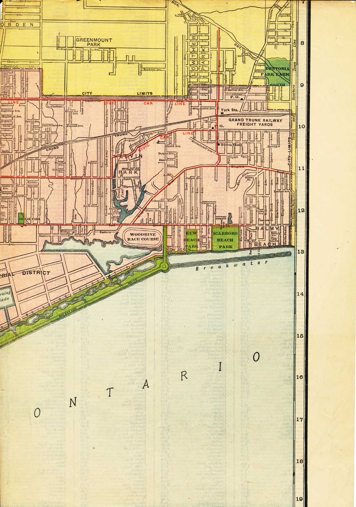
I often get requests from researchers who have seen their family in the 1901, 1911 or 1921 census of Toronto but can’t find the street they were living on a modern map because the street has disappeared or the name was changed. Where was Buchanan Street? Where was Cuttell Place? Where was Alice Street? Etcetera.
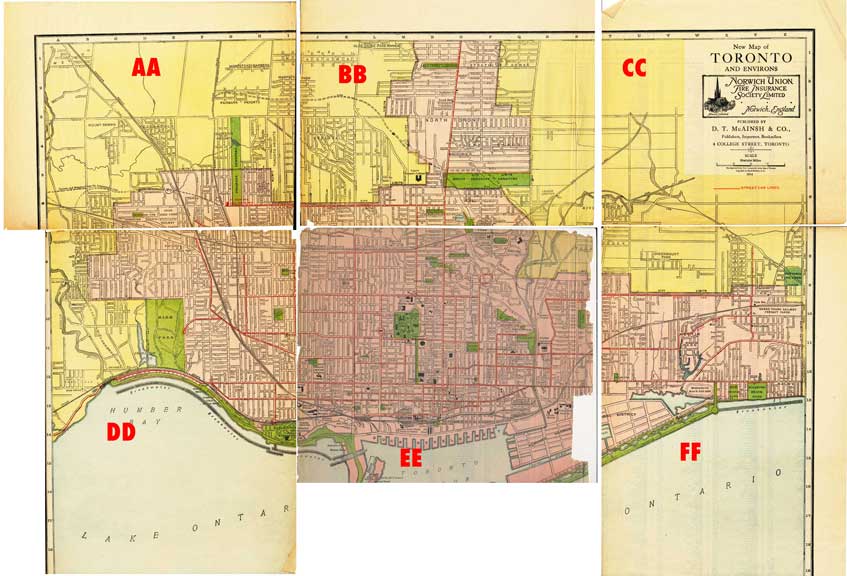
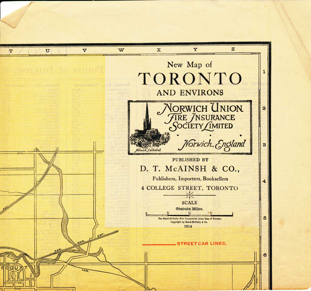
I picked up this map recently at a used book sale and find it a convenient reference. This “New Map of Toronto and Environs” was published in 1914 by D. T. McAinsh & Co., Publishers, Importers, Booksellers, of 4 College Street, Toronto. It is quite old and brittle and has subdivided along former folds into six sections. They are labelled AA, BB, CC, DD, EE and FF according to the thumbnail below. (Section EE encompasses the downtown core.) Choose which section you wish to view and then click on that section, below, and it will enlarge. Use the back arrow to return to this page. Enjoy! ♦